Aerial archaeology
Aerial archaeology is one of the methods used to search for traces of past mining activity in the high valley around Hallstatt. Differences in vegetation, shadowing and other signs visible from the air can help archaeologists to find objects and structures below the earth’s surface.Importance of aerial photography
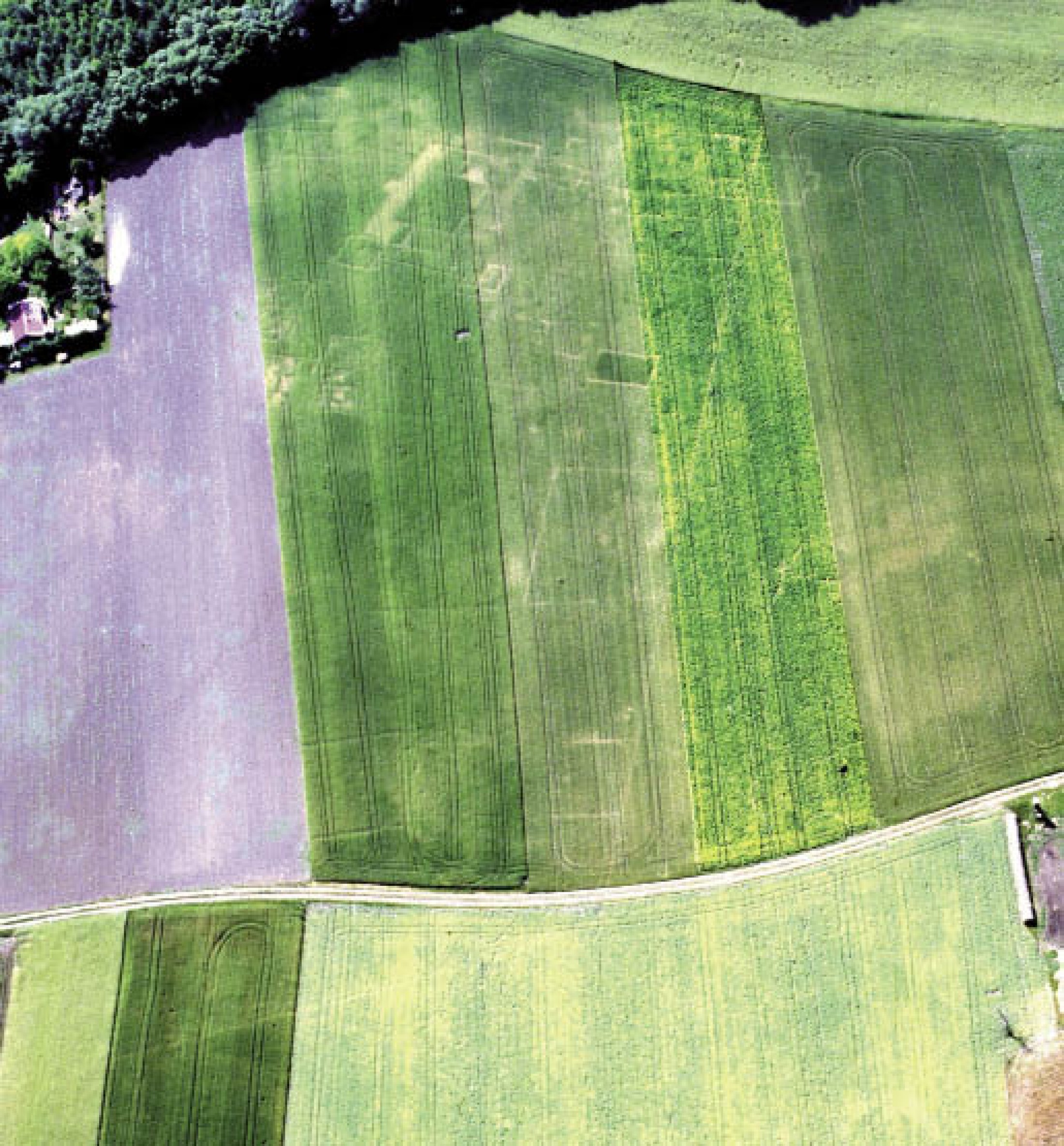
Archaeological monuments leave behind traces on the landscape
Aerial documentation
LiDAR laser scanning
Contribution to the preservation of monuments
Importance of aerial photography
Aerial archaeology is one of the most important methods used to discover archaeological sites. It is an essential, non-destructive part of archaeological prospection. Although aerial archaeology is primarily considered a complementary method applied in the search for archaeological sites, it is also important in the documentation and interpretation of archaeological landscapes and the follow-up of changes in our cultural heritage, above all relating to the latter’s state of preservation and actual imperilment.Archaeological monuments leave behind traces on the landscape
Subject to their state of preservation, ground monuments can in certain circumstances become visible on the surface. Abandoned burial sites, settlements or fortifications form specific patterns recognizable from an aerial perspective. Several visibility marks, mainly shadow marks, soil marks and crop marks, can reveal buried features.Aerial documentation
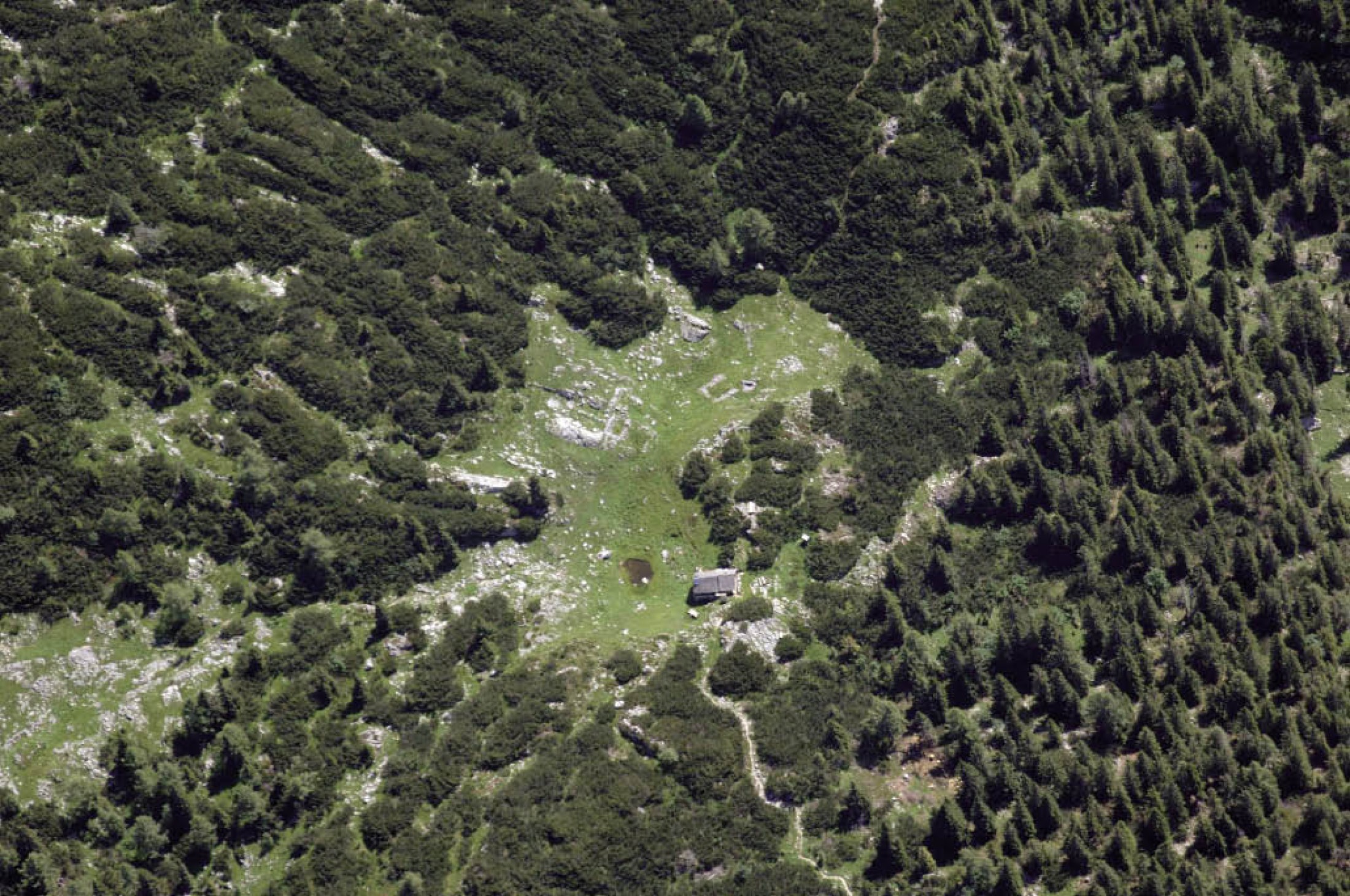
Decades of experience have shown that aerial prospection will reach ist full potential only with systematic and repeated surveys of extensive areas. It is important that the pilot or a passenger be archaeologically trained. During the flight, they inspect the landscape with the naked eye, looking for and identifying traces, and take highresolution digital pictures from the side window of the plane.LiDAR laser scanning
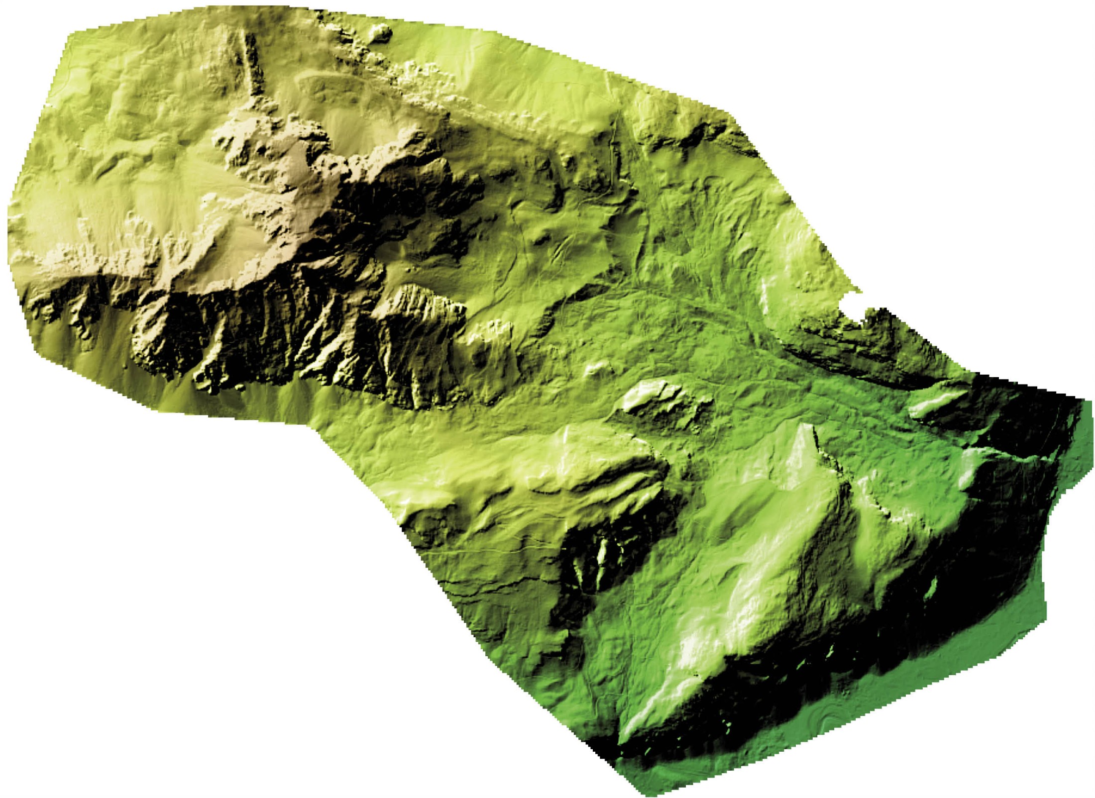
In the past few years, it has been shown that airborne laser scanning (LiDAR – Light Detection and Ranging) has a high potential with respect to the archaeological prospection of forested areas. Digital terrain models established on the basis of airborne laser data show on the surface archaeological features buried in the ground.Contribution to the preservation of monuments
When combined with the results from other prospection methods (geophysical prospection and intensive or extensive survey) or from excavations, the interpretation of data provided by aerial views enables us to make relevant scientific statements. Ideally, it will bring up a number of new questions that can be dealt with by purposeful prospection or excavation. Statements on the various preservation levels of the ground monuments establish a basis for the development of focused conservation strategies for an archaeological site or for an entire region.(Doneus, M. - Löw, C.)