Mass movements and their consequences
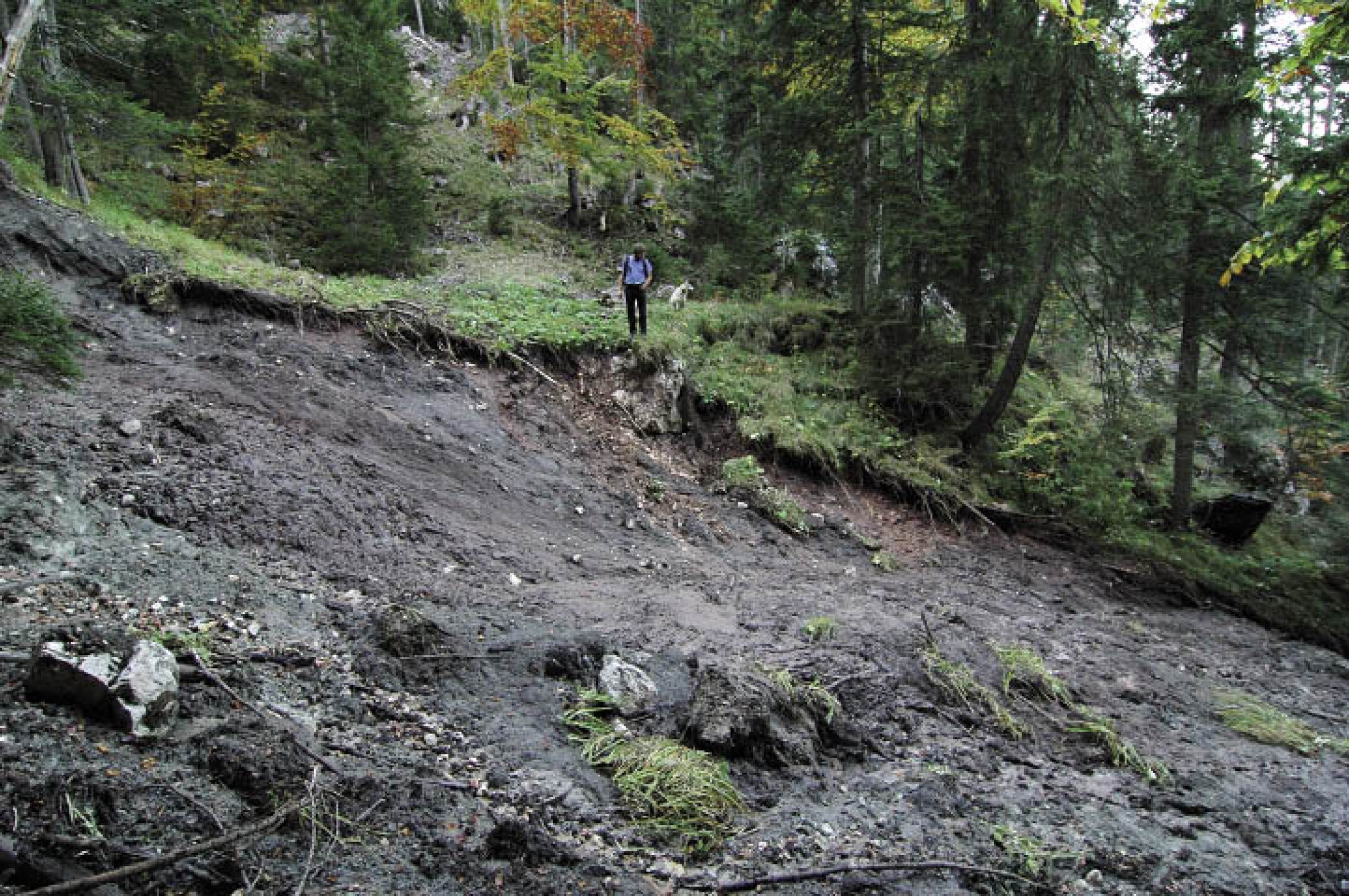
Rock falls, landslides, earth flows, debris flows and similar natural processes define the processes of slope movement (or mass wasting) by which soil and rock travel downslope under the force of gravity. The process does not require means of transport such as water, ice or air. In Hallstatt, as in many other Alpine regions, mass movements occur quite frequently, almost regularly. They are triggered by heavy precipitation or by thaw, but also by earthquakes or by human activities. Both the Bronze Age and the Iron Age mines have been significantly damaged by mass movements.Types of mass movement
Influencing factors
Spill-in material in the Bronze Age mines
Spill-in material in the Christian von Tuschwerk mine
Reconstructed scenario in the Christian von Tuschwerk mine
Spill-in material in the Stone Age mines
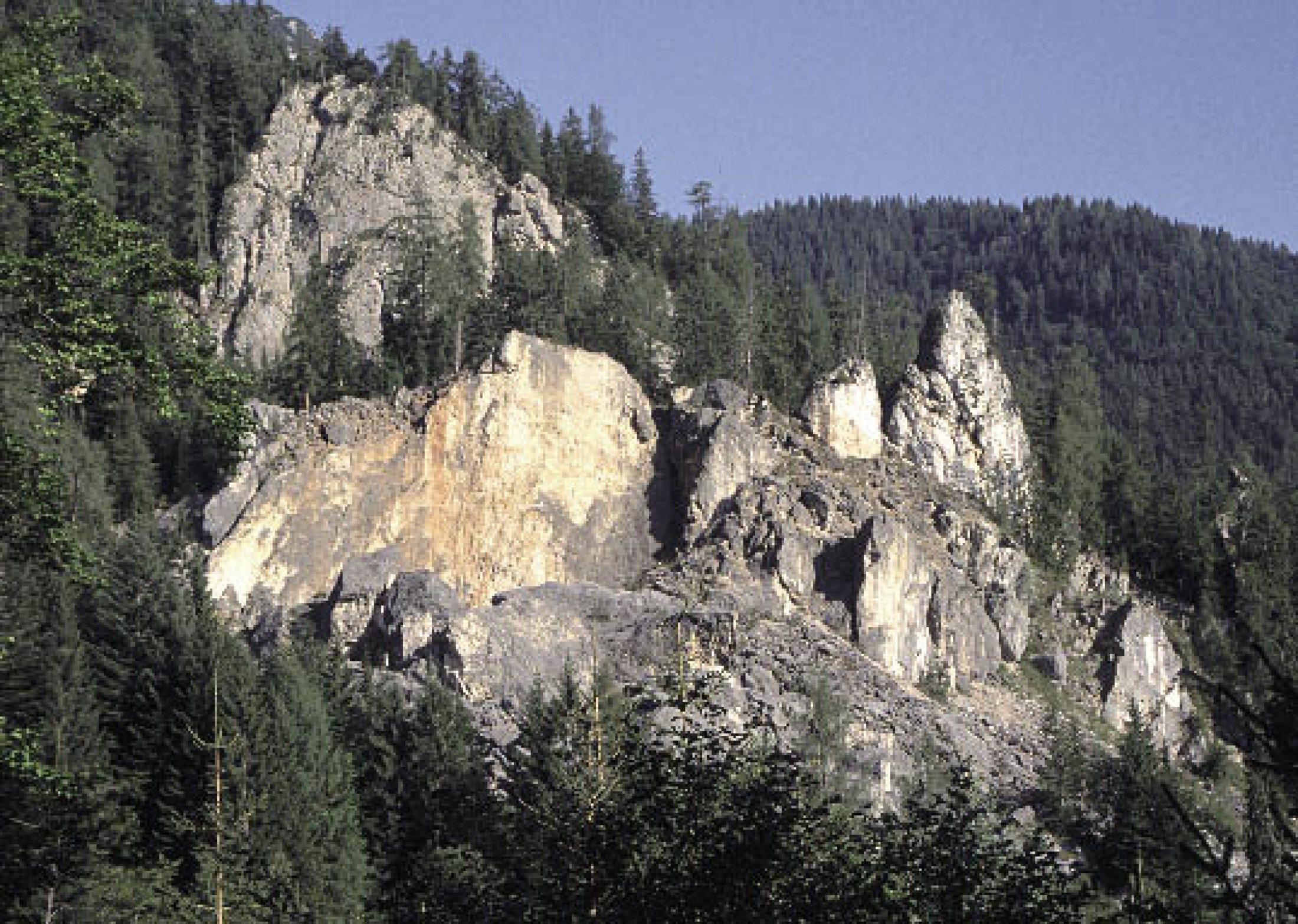
Rockfalls and landslides
Consequences of landslide
Types of mass movement
The processes differ in the kind of motion (falls, flows, topples and creeps) and in speed and duration. Rock falls and mud streams occur very rapidly and represent an acute danger for humans. This is not the case with other slope movement processes, such as slow earth flows or barely perceptible downhill creeps. But since such slow movements often take months, years or even decades, they may eventually lead to irreparable damages to buildings, roads and communication lines.Influencing factors
The geological constitution of the subsoil and the vegetation are of decisive importance in the triggering of mass movements. Areas with unstable subsoil made up of clay or marl being particularly prone. The upper area is most often delimited by one or several clearly discernible landslide scars, where rock and soil from the down-slope movement have been torn away. Such scars remain visible for a long time. Rock and soil are deposited downslopea, while the former surface of the terrain is burying the former terrain surface. After some time, the remodelling of this lower area is not longer easily discernible anymore.Spill-in material in the Bronze Age mines
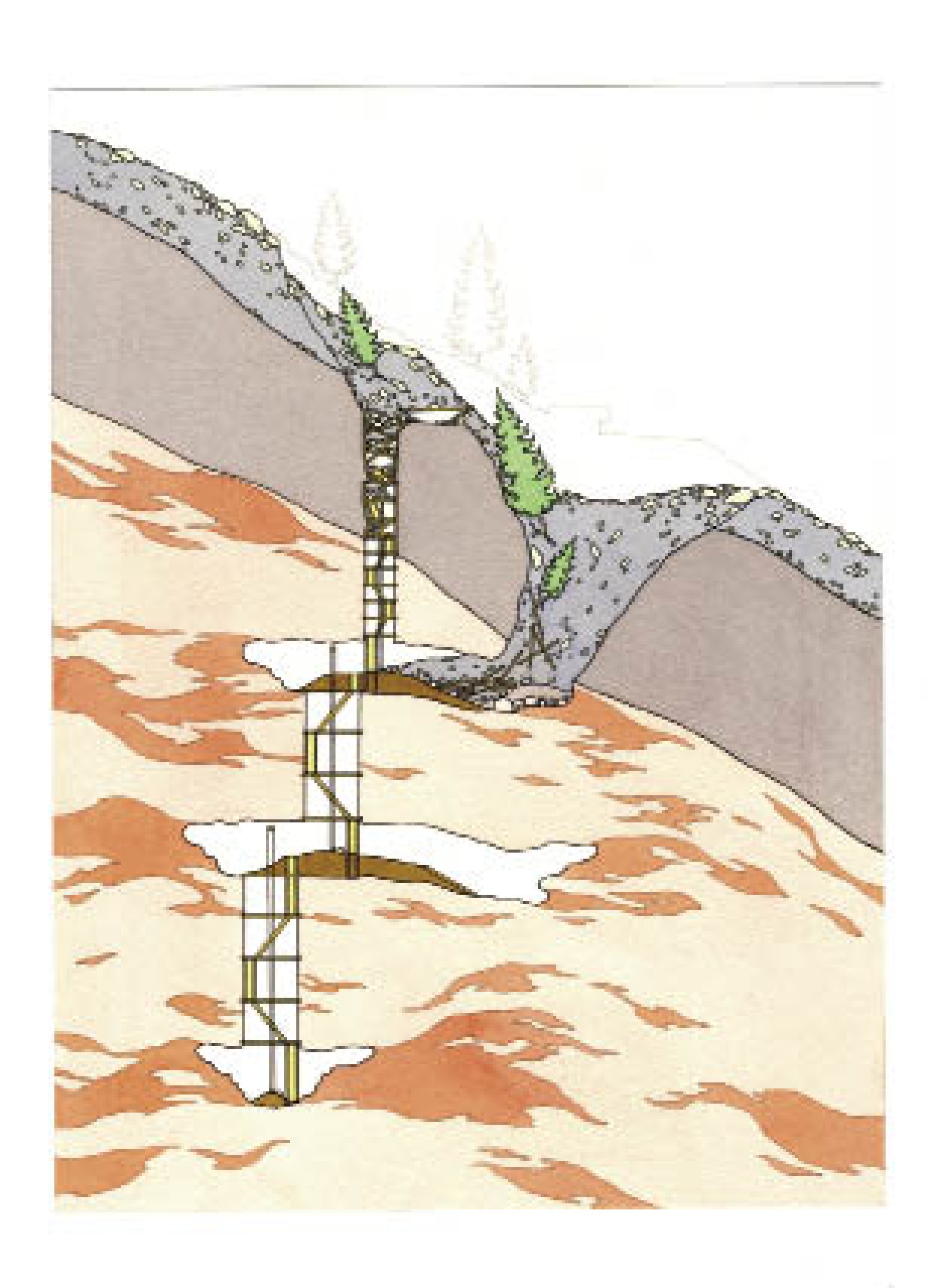
All known Bronze Age shafts are filled with surface material that has partially compressed down the scaffolding. The shaft on the Grünerwerk site is completely filled with fine-grained material, and the presence of tree roots associated with embedded humus embedded show that it slipped in from the surface. The fact that all wooden finds were discovered at undercuts in the ceiling of the former adit suggests that the shaft was at least partly filled with water at the time of the influx of surface material.Spill-in material in the Christian von Tuschwerk mine
The situation in the Christian von Tuschwerk is completely different. Here, the surface material consists of an unstratified mixture of clay and limestone fragments originating from the Plassen, the mountain to the immediate west. The fine-grained sediment that originally formed the basis of the material was subsequently eroded out and has only been preserved in some protected areas under the collapsed scaffolding of the shaft. Stratified fine material is also found immediately above the surface material.Reconstructed scenario in the Christian von Tuschwerk mine
This structure suggests the following scenario: triggered by heavy precipitation, water penetrated the shaft and first deposited finegrained sediments. At the same time, a massive slope movement occurred on the east side of the Plassen Mountain, where rockslope failure scars up to 30 metres high can still be seen in some places. Under this additional load, the slope movement now caused the ceiling to fall in. Surface material slipped into the shaft and, as a result, the entire shaft construction collapsed and was covered by the material penetrating from the surface. This material now filled the shaft almost completely, with the few remaining cavities subsequently filled by washed in finegrained sediments.Spill-in material in the Stone Age mines
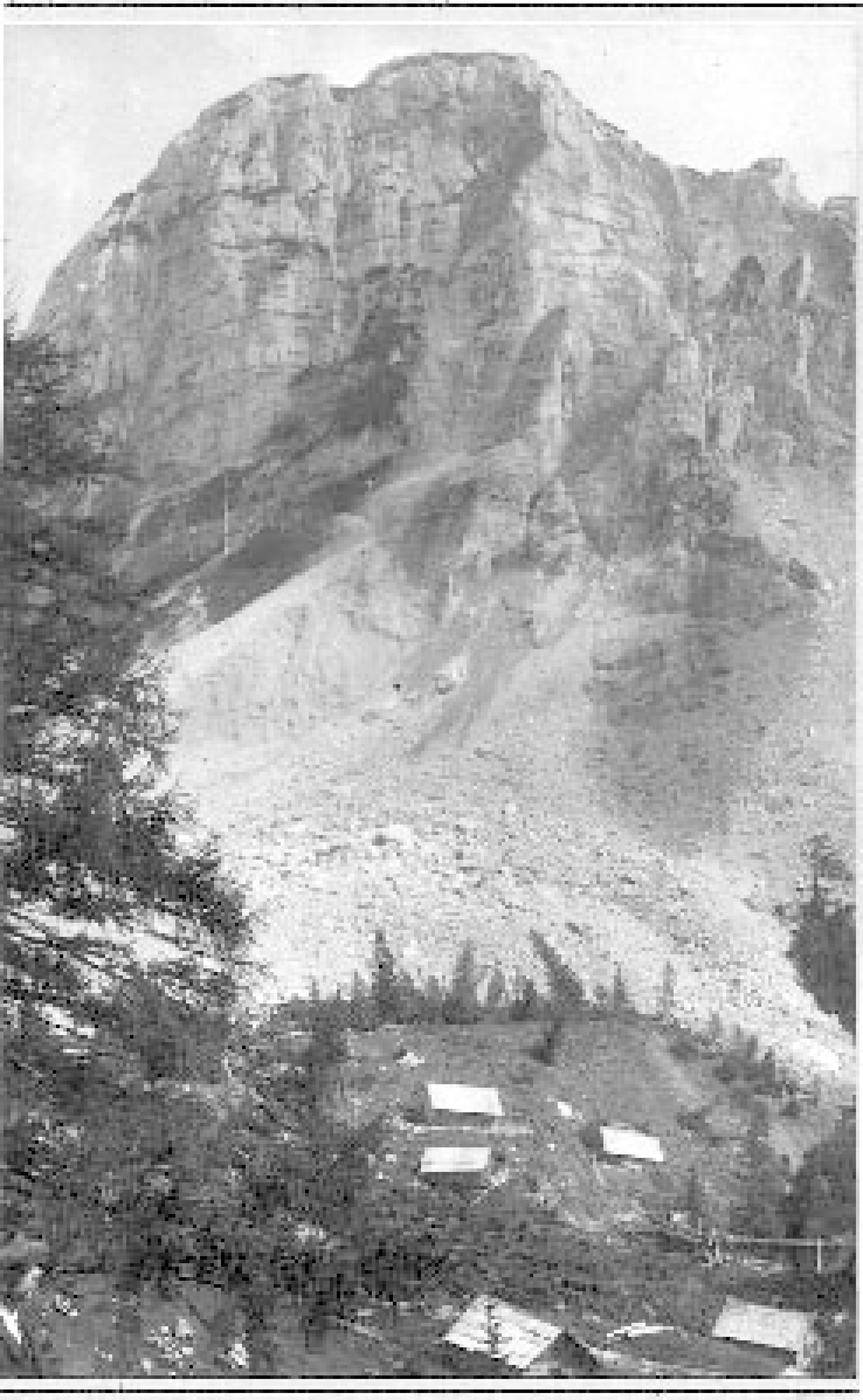
What caused the backfilling of the prehistoric mines in the Hallstatt period and the Bronze Age, and what were the consequences for the miners of the time? To answer these questions, the surface material from various find spots was subjected to geological-sedimentological analysis. The sediment is for the most part unstratified, with stones and rocks randomly distributed. The kind of stone, edged marl and limestone, suggests that they are not from the Plassen Mountain, but originate from nearby Steinbergkogel.Rockfalls and landslides
Geotechnical maps reveal that rock falls happened repeatedly on the Steinbergkogel, causing major debris flows into the Hallstatt High Valley. Similar events still occur in the Salzkammergut: recently in winter 2007/2008 in the Gschliefgraben near Gmunden, but also in 1982 at the Zwerchwand near Bad Goisern or 1920 at the Sandling Mountain near Altaussee. There, the collapse of about 200,000 m3 of rock triggered a earth flow that remained active for four weeks. It stretched for 3.7 km and destroyed several cabins.Consequences of landslide
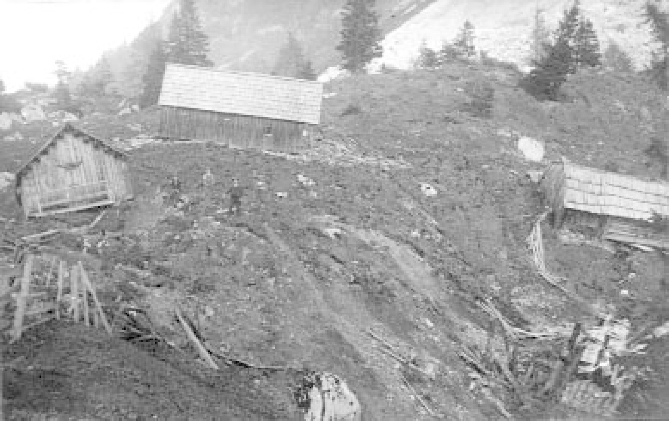
In the middle of the 4th century BC, a similar debris flow buried large parts of the High Valley. While most of the miners probably realized the danger and had time to reach safety, they could not stop the earth flow that penetrated into the mine and completely destroyed it. It destroyed the source of their livelihood and for decades made the valley unsuited for settlement.However, this catastrophe - to which 'The Man in the Salt' might also have fallen victim - was not the end of prehistoric salt mining. The Hallstatt miners probably did not leave the rich deposit, but moved the mining to a better protected place. In fact, the mining field and the miners’ dwellings of the Late Iron Age are located on the Dammwiese, at a safer, higher altitude.
(Ehret, D.)