Prehistoric farming
The cultivation of high alpine pastures is already known in the Neolithic period. The remains of 21 prehistoric mountain huts have been found on the eastern Dachstein plateau. Between the Dachstein Mountain and Lake Hallstatt, the Bronze Age salt metropolis of Hallstatt had only few arable resources. Therefore, it can be assumed that the large and diverse meadows of the Dachstein mountains were used to supply the miners with food.The concept of farming
Remains of prehistoric huts on the eastern Dachstein plateau
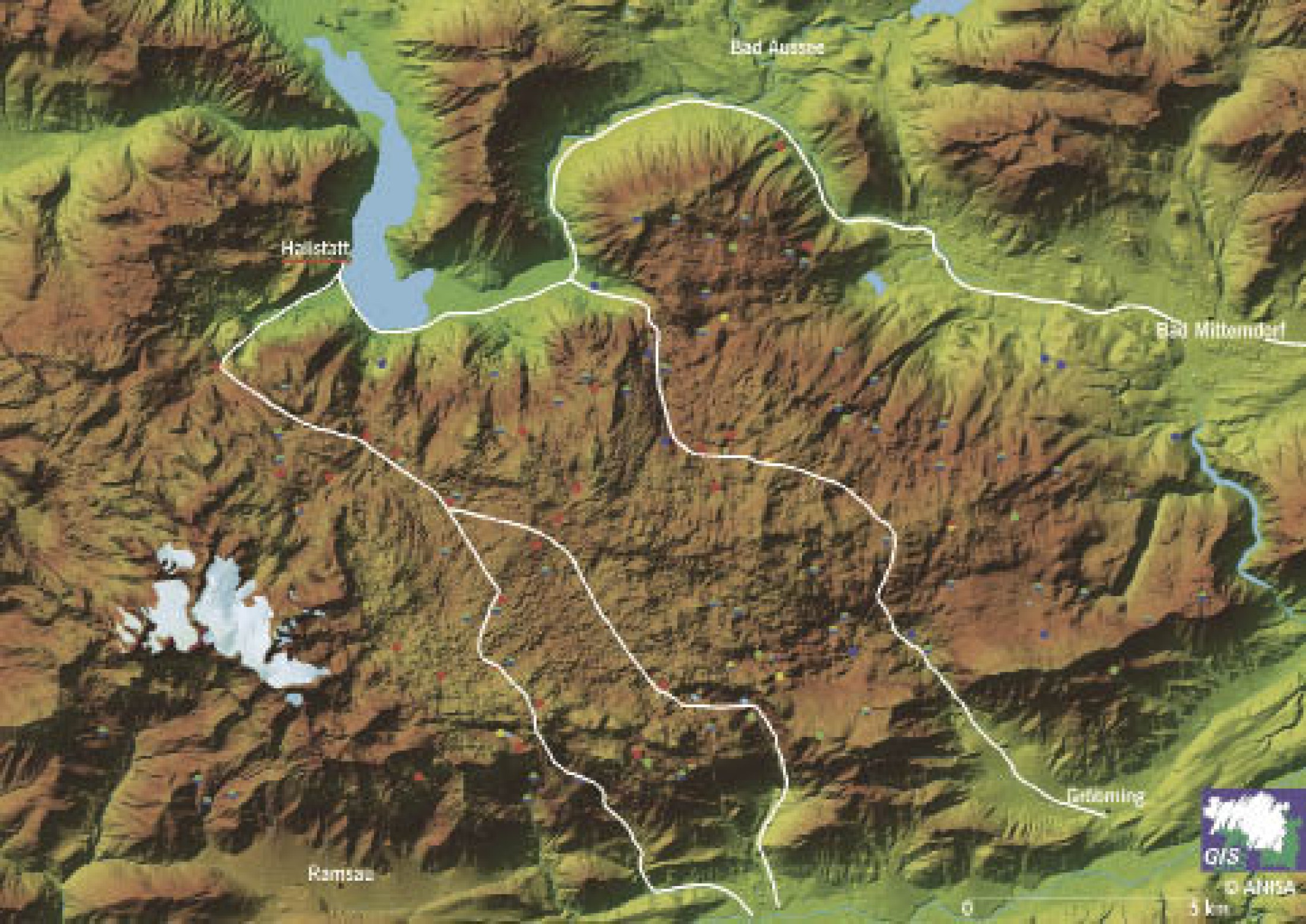
Location of the prehistoric huts
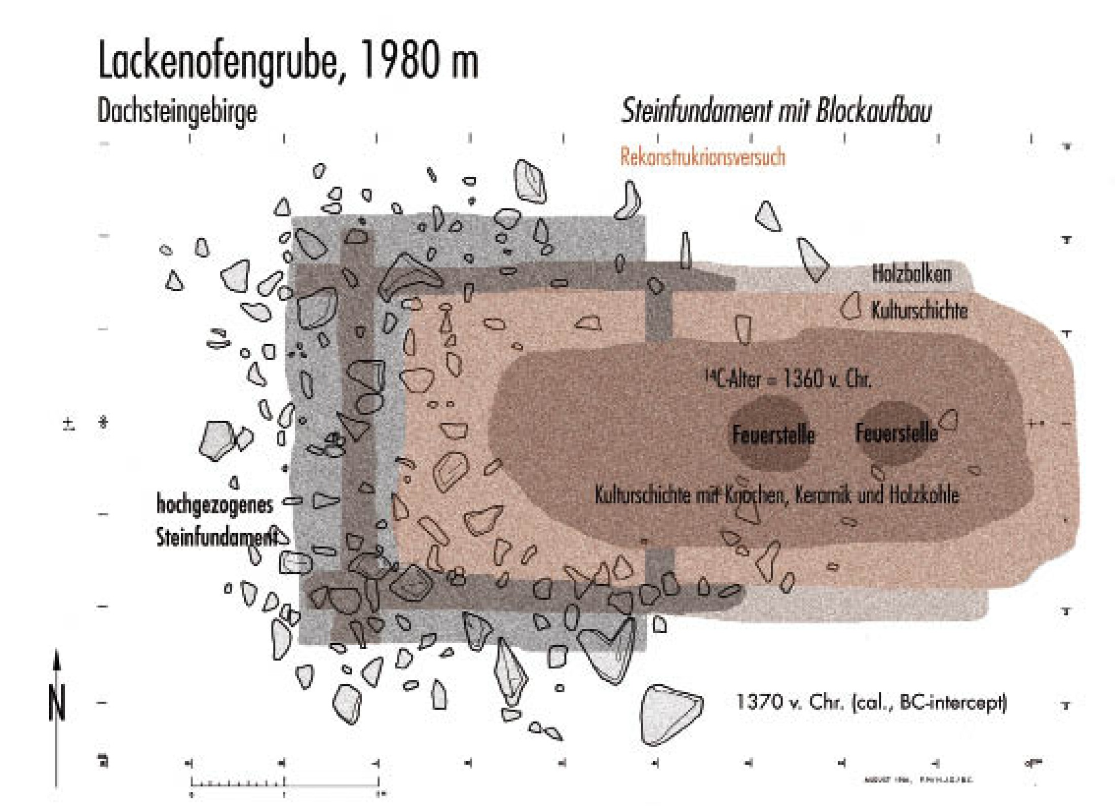
Bronze Age mountain huts at the Lackenofengrube and Königreichalm sites
Construction method used for Bronze Age huts
The concept of farming
The term ‘alpine pasturing’ covers several ways of using pasture. In traditional alpine pastoral cultivation, milk is processed on the spot, in a croft or shieling, but sometimes it is taken down to the valley for further processing. The concept can also include livestock breeding for meat production. Alpine pasturing freed up the pastures in the valley, thus allowing for grain farming and the cultivation of winter feed lower down. The alpine pasture and the home farm formed an inextricably linked economic unit, crucial to survival in the heart of the mountains.Remains of prehistoric huts on the eastern Dachstein plateau
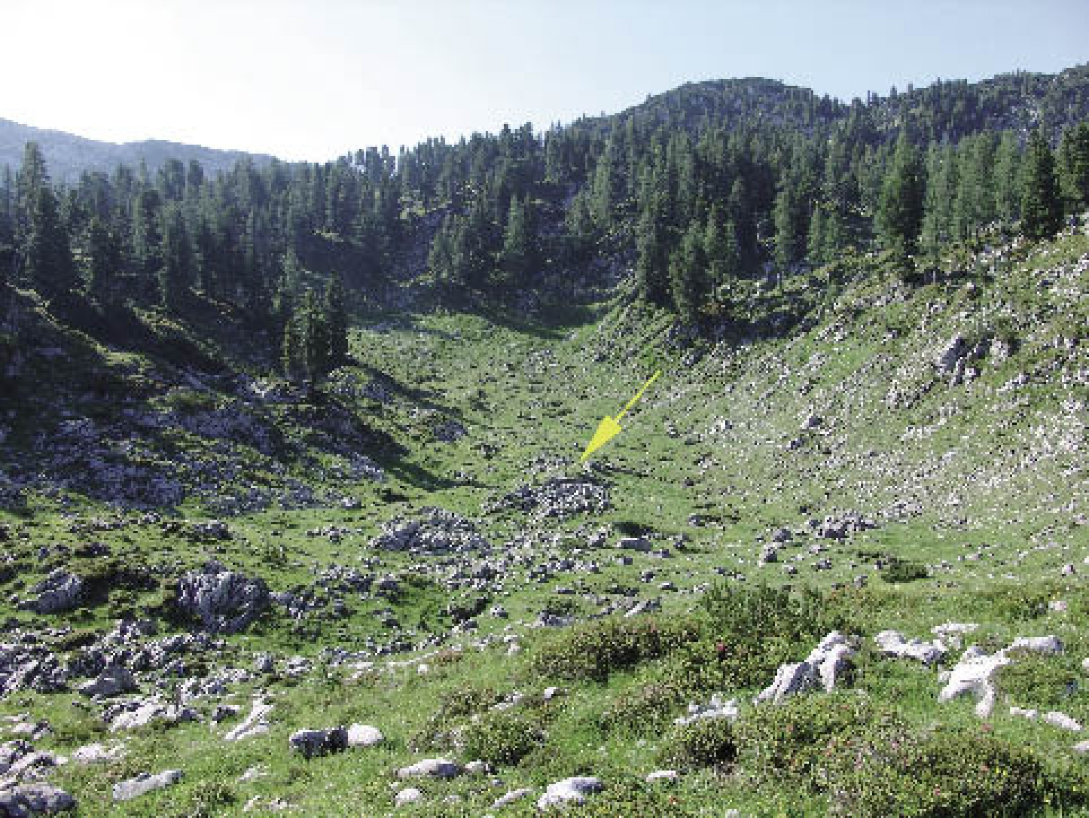
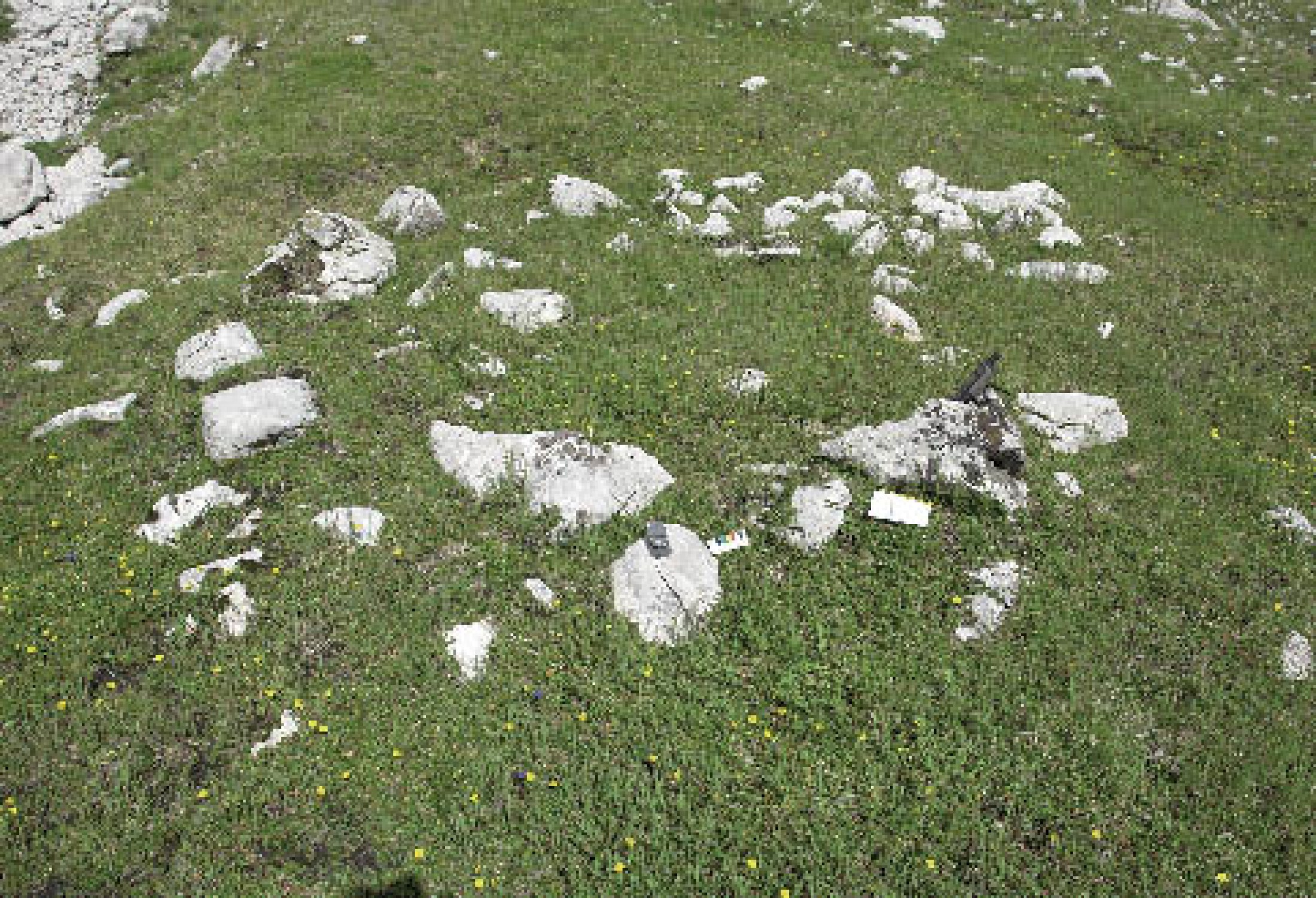
Remains of 21 prehistoric huts have so far been discovered on the large (280 km2) eastern Dachstein plateau. Highprecision radiocarbon analyses of charcoal date the majority of them to the Middle Bronze Age. Amidst the karst, only an expert eye will discern the remains of the hut in the form of weathered rings of stones. Many years of field research were needed for their discovery. All hut circles have been found in areas of natural pasture at between 1300 m and 2100 m. They testify to the existence of prehistoric alpine pasturing in the period from 1700 BC down to around 1000 BC.Location of the prehistoric huts
The lack of pasture in the valley promoted the cultivation of the natural high-alpine meadows. These were often created in naturally-drained karstic hollows, where few trees grew and which had access to adjacent upland meadows. The limestone massif of the Dachstein has many karstic hollows with their own microclimate. Cold lakes form in these ‘pits’, above altitudes of 1200 m. Drainage-inhibiting clays and washed in vegetable matter contributes to the formation of a fertile humic layer. Snowmelt is late and hoarfrosts are common from late summer onwards. Thus the growth of bushes and trees is restricted, favouring the formation of natural pastures with grass and herbs.Bronze Age mountain huts at the Lackenofengrube and Königreichalm sites
Remains of Bronze Age huts are found mainly in such locations. So far, the remains of two Bronze Age alpine huts have been unearthed, one in the Lackofengrube at an altitude of 2000 m, and one at the Königreichalm at 1730 m. Skeletal remains of cattle, pigs or dogs, goats or sheep and horses have been found at the Lackofen site. The bones are exclusively those of young animals, suggesting that they were kept only temporarily, since otherwise there should have been bones of older animals.Construction method used for Bronze Age huts
Both huts were presumably cabin-like log constructions with dry-stone foundations. These stone walls were thicker on the rear or weather side, while both huts were open southwards. Two fire pits were situated in front of each hut. Bronze flanged axes found in the high forest up on the Dachstein might suggest the existence of some timber industry in connection with salt mining in Hallstatt, while bronze spear heads suggest hunting. In fact, many a Säumer – a mule driver or packhorse handler – transporting salt and wine over the passes, might have taken a shortcut over the Dachstein when travelling southwards. The use of such high-level routes presupposes the existence of waystations for feeding and watering people and animals in transit.(F. Mandl)